All of the images below are "thumbnails."
To see the full size pictures, just click on them
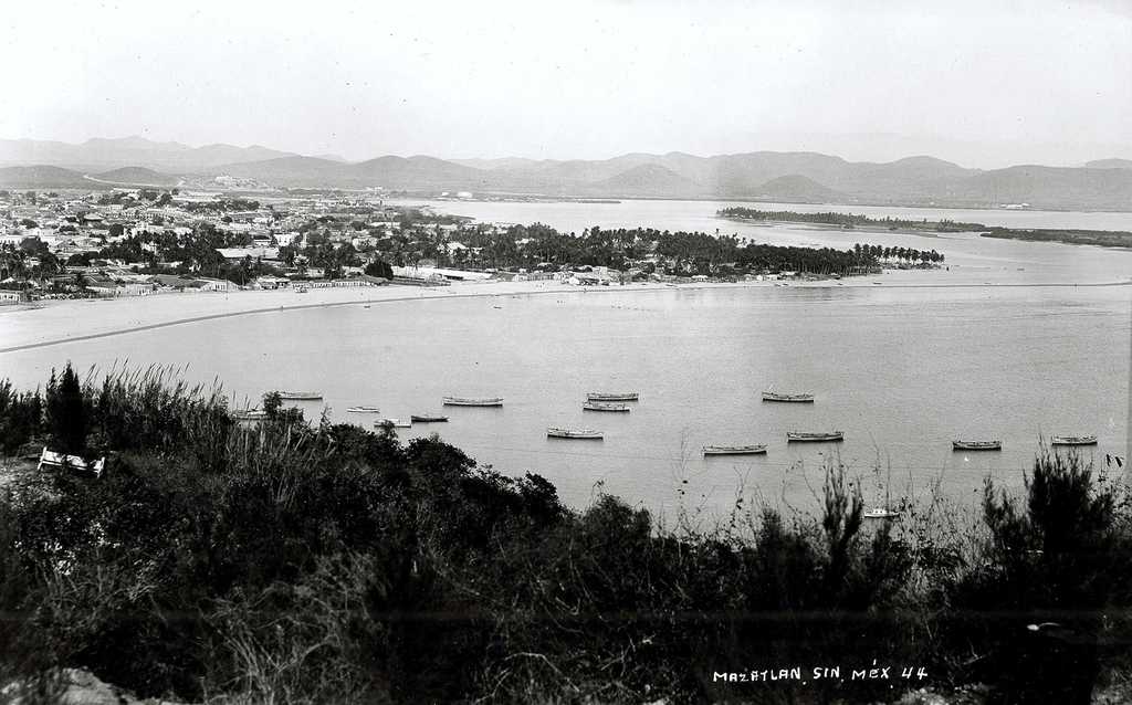
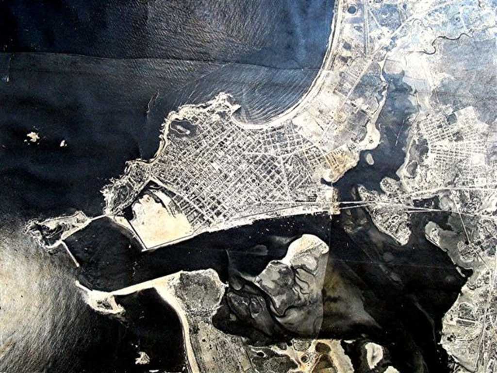 Mazatlan in 1957, just after the works to
fill with sand what actually is the Playa Sur
Colonia. Center right shows the Estero del
Infiernillo, that is fed by Arroyo de los Javalines
( right upper corner of picture ) that looks like a
snake.
Mazatlan in 1957, just after the works to
fill with sand what actually is the Playa Sur
Colonia. Center right shows the Estero del
Infiernillo, that is fed by Arroyo de los Javalines
( right upper corner of picture ) that looks like a
snake.
 One of the oldest pictures of paseo olas
altas, taken in 1870.
One of the oldest pictures of paseo olas
altas, taken in 1870.
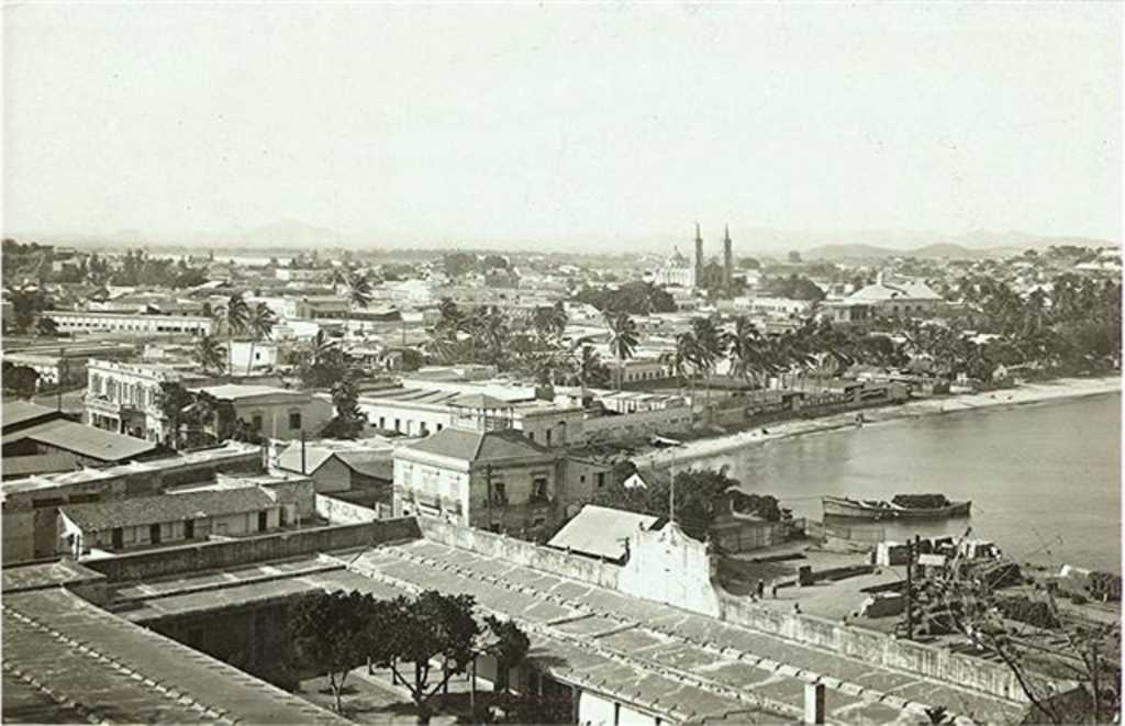 The foreground shows the custom house just
besides the playa sur beach, where a very good dock
installation served for very important maritime
commerce between Mazatlan and overseas ports in the
end of 18th century
The foreground shows the custom house just
besides the playa sur beach, where a very good dock
installation served for very important maritime
commerce between Mazatlan and overseas ports in the
end of 18th century
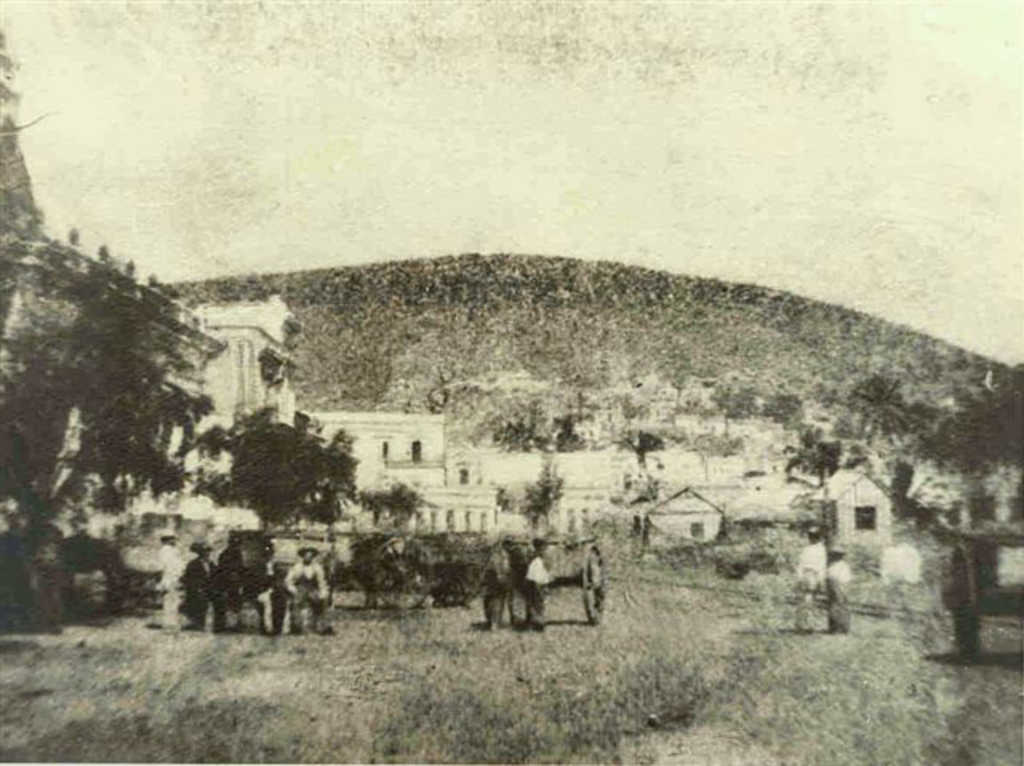 Another very old view of calle Venustiano
Carranza, showing the train rails along the street
used to load and onload items in the custom house
dock.
Another very old view of calle Venustiano
Carranza, showing the train rails along the street
used to load and onload items in the custom house
dock.
 Paseo del Centenario in the foreground,
Glorieta Germania and the light house of Mazatlan
around 1930
Paseo del Centenario in the foreground,
Glorieta Germania and the light house of Mazatlan
around 1930
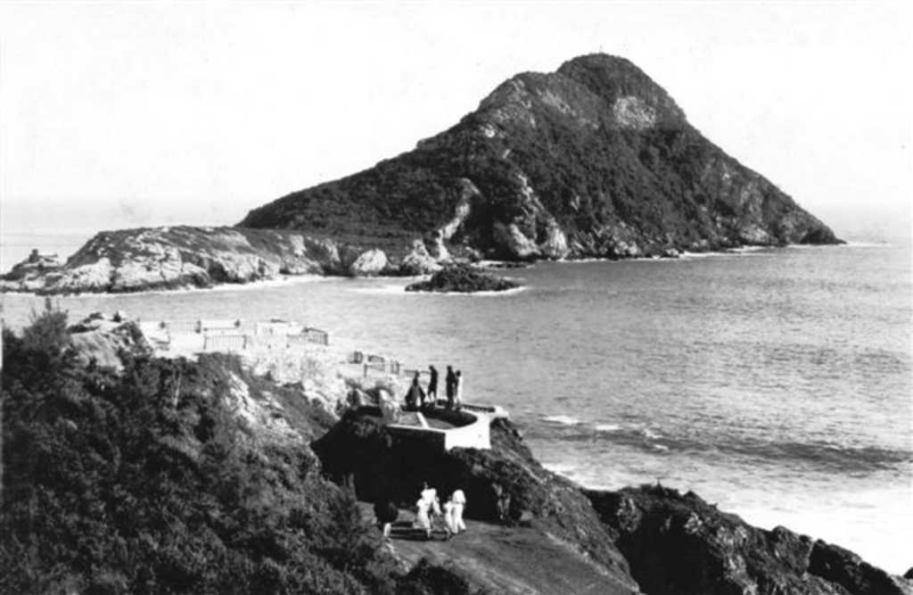
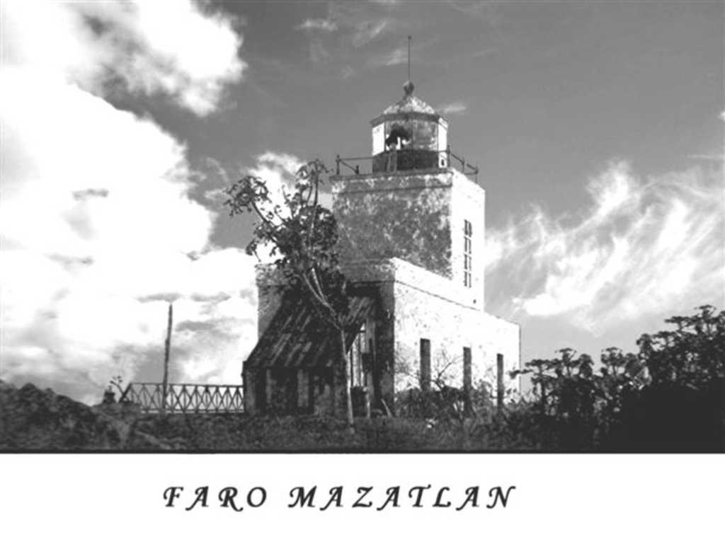 The light house of Mazatlan in 1890. It is
the second highest natural light house in the world
and ligth can be seen from 30 nautical
miles.
The light house of Mazatlan in 1890. It is
the second highest natural light house in the world
and ligth can be seen from 30 nautical
miles.
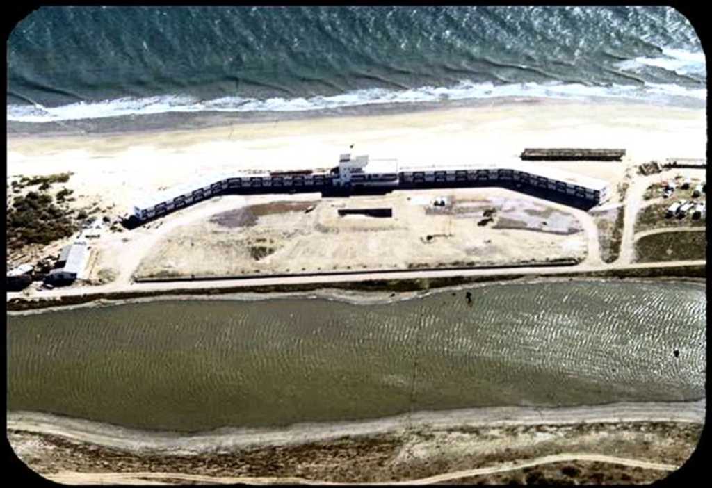 Hotel Playa in 1950. The lagoon in the
foreground today is the Zona Dorada.
Hotel Playa in 1950. The lagoon in the
foreground today is the Zona Dorada.
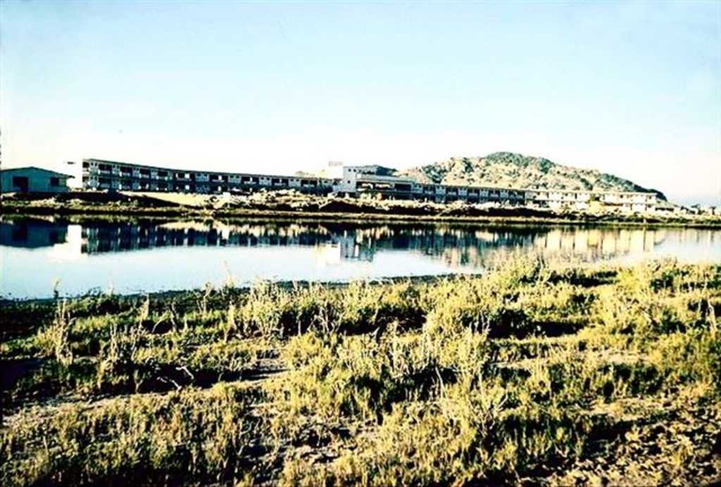 Another view of Hotel Playa in 1950.
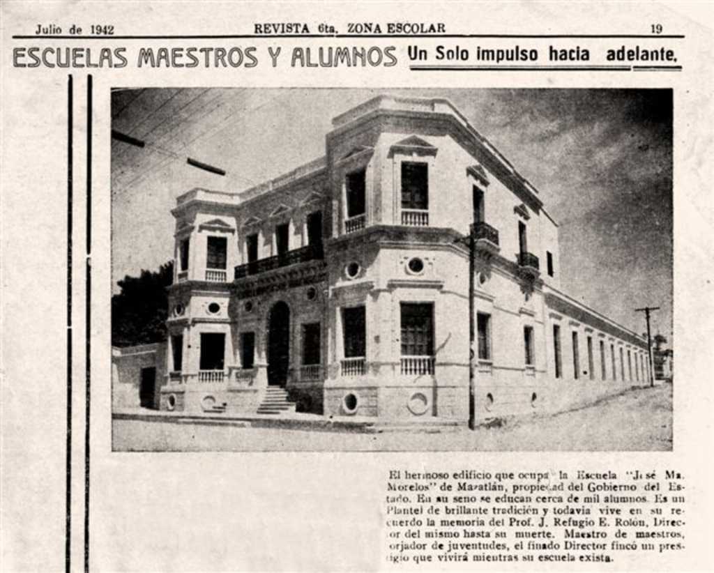 Building of Escuela Morelos in Constitucion
street. It was demolished during the administration
of mayor of mazatlan Ricardo Urquijo and a new much
inferior facility for the school was built in same
place. This is called progress.
Building of Escuela Morelos in Constitucion
street. It was demolished during the administration
of mayor of mazatlan Ricardo Urquijo and a new much
inferior facility for the school was built in same
place. This is called progress.
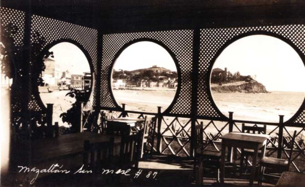 The view from inside Carpa Olivera, which was
a big bar, restaurant and swimming pool, as was
built over the rocks inside the ocean.
The view from inside Carpa Olivera, which was
a big bar, restaurant and swimming pool, as was
built over the rocks inside the ocean.
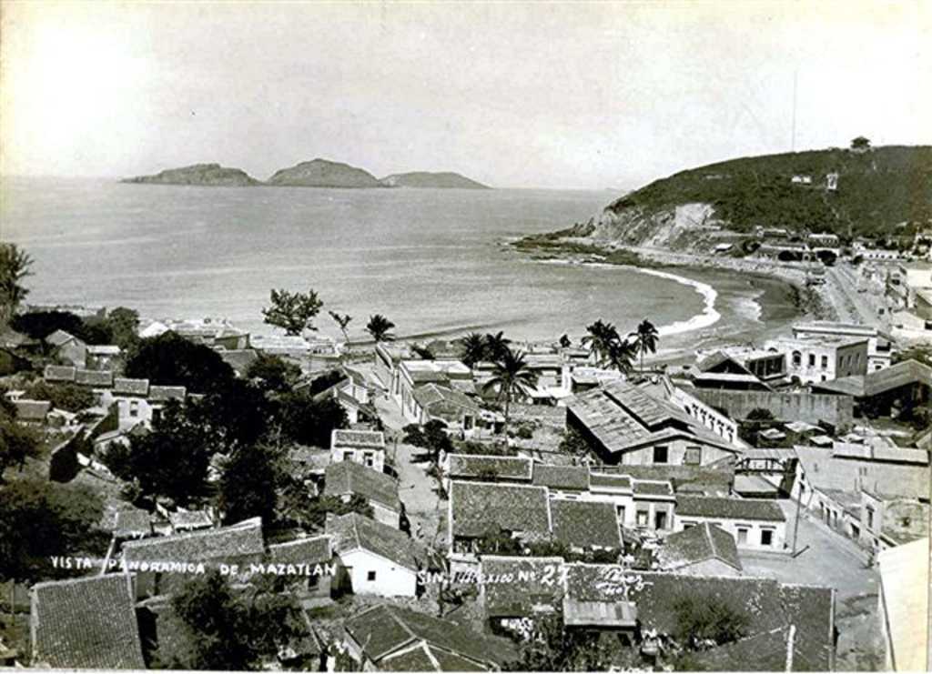 A view of the Paseo Olas Altas.
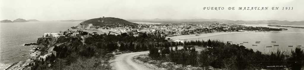 The best picture ever taken of Mazatlan in
1933. 3 pictures with a very high resolution were
used to form this one, and it is becoming a classic
picture above the traditional one of Olas
Altas.
The best picture ever taken of Mazatlan in
1933. 3 pictures with a very high resolution were
used to form this one, and it is becoming a classic
picture above the traditional one of Olas
Altas.
 This one is the right third part of previous
picture of Mazatlan in 1933.
This one is the right third part of previous
picture of Mazatlan in 1933.
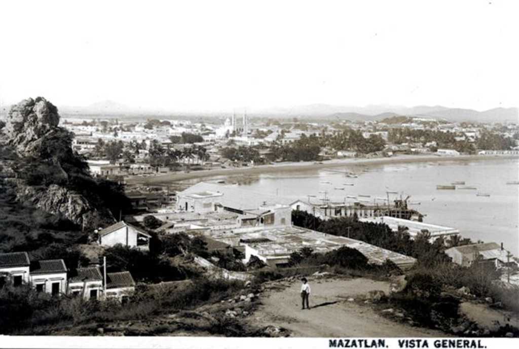 Cerro de la Cruz in the left, and a
magnificent view of old Mazatlan in 1910.
Cerro de la Cruz in the left, and a
magnificent view of old Mazatlan in 1910.
Quote of the day:
We give dogs time we can spare, space we can spare and love we can spare. And in return, dogs give us their all. It's the best deal man has ever made.
M. Acklam
We give dogs time we can spare, space we can spare and love we can spare. And in return, dogs give us their all. It's the best deal man has ever made.
M. Acklam
Sitemap
Go up to General Information on Mazatlan Go up to Home Page of Nadine Loves Henry
Go back to Other Mazatlan Photos Continue with Mazatlan Resources